Editor’s Note: A version of this article originally appeared in the weekly weather newsletter, the CNN Weather Brief, which is released every Monday. You can sign up here to receive them every week and during significant storms.
NOAA’s hurricane hunters might be just as busy now as they were during hurricane season. However, it’s not hurricanes they are flying through, but the atmospheric river systems plaguing California since Christmas week.
Atmospheric rivers may not make headlines in the same way hurricanes do, but they can have extreme consequences.
“Atmospheric rivers can span the whole Pacific. They are long and narrow, but they’re way larger than hurricanes,” Atmospheric River Reconnaissance Coordinator Anna Wilson said.
They are crucial to the West Coast. Half the rain and snow the West gets comes from atmospheric rivers, which are plumes of moisture coming in from the Pacific Ocean. And they cross an area with very few observation sites, making them challenging to forecast.
Until the last few years, forecasters had to rely solely on satellites and forecast models for forecasting atmospheric rivers, which can become very muddy without truly knowing what’s happening inside the storms.
The University of California-San Diego, the Scripps Institution of Oceanography, and the Center for Western Weather and Water Extremes have teamed up with the NOAA Hurricane Hunters who are able to drop instruments called “dropsondes” inside an atmospheric river, to relay pinpointed live weather data. The information is immediately put into weather forecast models, which improves the accuracy of the forecast dramatically.
“With the dropsondes released by the hurricane hunters, we get profiles of moisture, temperature, winds, in the lower part of the atmosphere, which are really critical for understanding the atmospheric river’s structure,” Wilson said.
The information not only improves the overall knowledge of what atmospheric rivers are capable of, but improves immediate forecasts.
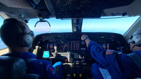
“NOAA aircraft are flying in these weather systems and validating the models,” Captain Jason Mansour, pilot and aircraft commander of the NOAA Gulfstream IV Hurricane Hunter aircraft. “Then the NOAA National Weather Service is more prepared to predict where and when these systems will make impact and how much of an impact that’s going to be.”

Mansour is a seasoned veteran of the hurricane hunters. He says the ride might be a little less bumpy for the atmospheric rivers, but the mission is the same.
“We are effectively part of the early warning system for the atmospheric rivers across the board,” Mansour explained.
Parts of California have seen nearly a foot of rain since Christmas weekend. San Francisco has received more than nine inches of rain, while Lake Tahoe has seen more than 11 inches. In the higher elevations, the snow totals have been staggering as well. Parts of the Sierra have more than twice the snowpack than they would typically see this time of year. Mammoth Mountain has seen nearly 120” of snowfall just since December 26. And that’s not all.
This week will begin the fourth week of consecutive rain and snow for California. The series of atmospheric river events, occurring in rapid succession, are being referred to by experts as an “atmospheric river family.”
“Which basically means a series of them one after the other with maybe a day or so in between,” Wilson explained. “If it came by itself, it wouldn’t be hugely impactful, but because it came on the heels of three other ones, it has much higher hydrologic impacts than it would otherwise.”
The West has been on the forefront of hydrological woes. Experiencing a mega-drought, resulting in dry lake and riverbeds, intense wildfires and potential water shortages. The pendulum has now swung, and California is now facing extreme drought and extreme flooding simultaneously, as the current rainfall won’t solve California’s drought.
“What we need in order to get out of the drought is not an insanely wet month where a lot of that water is not going to be savable because of runoff,” Wilson explained. “What we need is a couple of steady wet years, and it’s coming in a way where more of it can percolate into the ground.”
Wilson added she has seen the pendulum swing many times in California, but not like this.
“The swinging back and forth is potentially getting wider and wider,” Wilson said. “California is known for its volatile weather swings, but it does seem like in recent years it’s been, like now, we’re going from this new record of dry to this new record of wet.”
The rain will continue this week for the West, with no real shut-off to the available moisture in the near future.
CNN Meteorologist Haley Brink contributed to this story.
"now" - Google News
January 09, 2023 at 11:02PM
https://ift.tt/IZOsrLd
NOAA's hurricane hunters are now targeting the West Coast's atmospheric rivers - CNN
"now" - Google News
https://ift.tt/lvxHGQs
Bagikan Berita Ini


0 Response to "NOAA's hurricane hunters are now targeting the West Coast's atmospheric rivers - CNN"
Post a Comment